Using the Layer Importer to load data into MongoDB
It is possible to use the Layer Importer to load data into a MongoDB database from another format such as a shapefile.
Note
Please see the section on Loading data into a database via the Layer Importer for more details.
Make sure to select the workspace and store that match the existing MongoDB store. All data imported into GeoServer will be first added to the MongoDB database first.
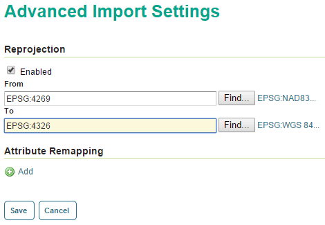
The only caveat to this process is that the data must be stored with a coordinate reference system of EPSG:4326. So click the Advanced tab and in the “Reprojection” section verify the contents of the From field. If the entry is not EPSG:4326, click the Enabled checkbox and enter EPSG:4326` in the To field.

Reprojecting to EPSG:4326
Usually the import process will be successful, but failures will occur most likely in two cases:
- Multi-geometry support. This is only available in MongoDB version 2.5 and newer.
- Self-intersecting polygons. These must be resolved with an external tool before import.