Print
With GeoExplorer you can create PDFs of the current map composition. PDFs can greatly simplify the process of printing maps.
Once you’ve completed your map composition, click Print on the GeoExplorer toolbar to get started.

Print tool
Note
Due to licensing issues, some layers cannot be printed. If your map composition contains any restricted layers, they will be excluded from the PDF output. If your map composition contains ONLY restricted layers (for example, Google Terrain data) a warning message will be displayed advising the layer(s) cannot be printed.

Print restrictions
Print Preview
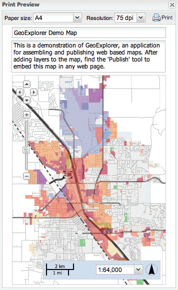
The Print Preview dialog box provides a preview of the PDF output. You can customize a number of PDF print parameters, as well as the PDF title and subtitle.

Print Preview
Paper Size
The Paper size list provides three options for setting the size of the resulting PDF. The options are:
| Paper Size | Width | Height |
|---|---|---|
| A4 (default) | 210 mm | 297 mm |
| Legal | 8.5 in | 14 in |
| Letter | 8.5 in | 11 in |
Resolution
The Resolution list provides three options for setting the resolution of the rasterized map image in the output PDF. The options are:
- 75 dpi (default)
- 150 dpi
- 300 dpi
Map Title and Description
A title for the PDF output will appear at the top of the print page. A default title, GeoExplorer Demo Map, is provided but you can change this to include your own title. Below the title is a default description for the map, which again may be altered as required.

PDF title and description
Map
The main component of the PDF is the map. You can adjust the pan and zoom settings of the map using the tools provided in the Print Preview dialog box. However, if you need to adjust the composition of layers, close the Print Preview dialog box and make the necessary changes in the main Map Window.
Print button
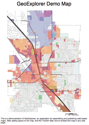
Once the PDF output has been configured as required, click the Print button to create a PDF file. Your browser application will download or display this file, depending on how your browser has been configured.

Finished PDF